

Zoek naar Campings en stacaravans in Alton
 Verander van gedachtenBoek hotels met gratis annulering
 Wees kieskeurigZoek in bijna een miljoen accommodaties wereldwijd
Bekijk de prijzen voor deze datums
Over twee weken
Over twee maanden
Over drie maanden
Over vier maanden
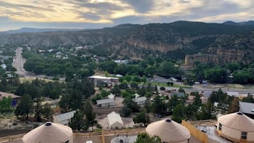
Onze beste keuzes voor camperterreinen in Alton
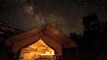


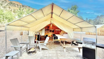
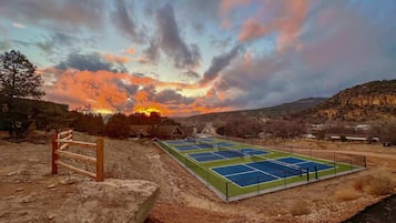
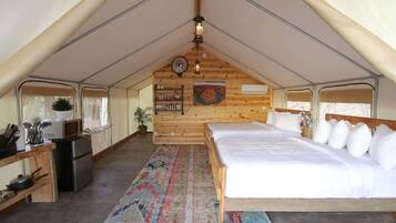
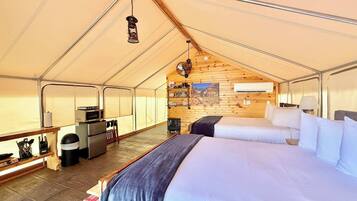
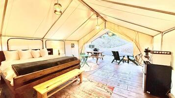
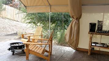
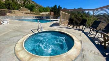
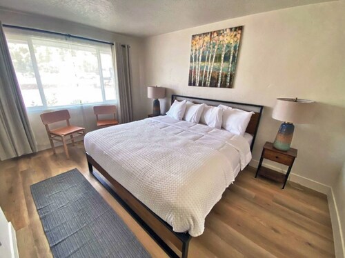
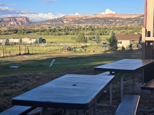
Glamping Tent # 7 in East Zion Resort (twee queensize bedden)
Glamping Tent # 7 in East Zion Resort (twee queensize bedden)Orderville
10.0 van 10, Uitzonderlijk, (4 beoordelingen)
'Excellent location to stay near Zion National Park. The coffee shop near by is amazing! '

Christina
De prijs is € 268
inclusief belastingen en toeslagen
5 jul - 6 jul

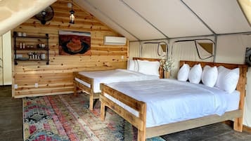
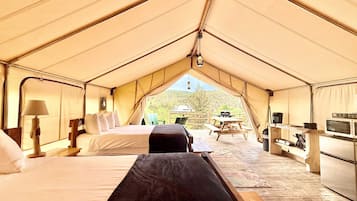
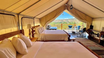
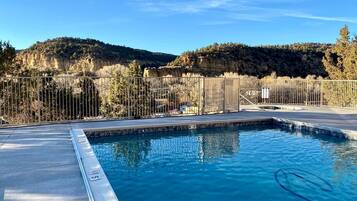
Tent # 1 op East Zion Resort (twee queensize bedden)
Tent # 1 op East Zion Resort (twee queensize bedden)Orderville
10.0 van 10, Uitzonderlijk, (6 beoordelingen)
'Stayed with two grandkids and had a great time. Perfect location, nice property with wonderful pool.'
Allan C.
De prijs is € 284
inclusief belastingen en toeslagen
5 jul - 6 jul
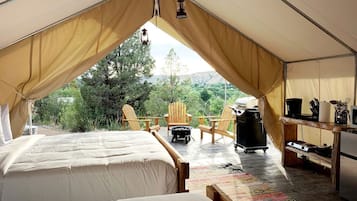
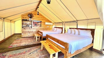
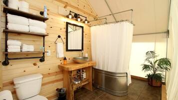
Glamping Tent # 2 in East Zion Resort (twee queensize bedden)
Glamping Tent # 2 in East Zion Resort (twee queensize bedden)Orderville
9.8 van 10, Uitzonderlijk, (10 beoordelingen)
'Such a great time! Tent was very clean and very well decorated! The only downside was no locks on the door, however we felt very safe. Very small town but larger towns within distance. Archie’s food truck next door was so good and fun! Staff was fabulous with check in and check out , and questions! Really enjoyed. UTV tour was also right next door at Roam and was amazing! '
Kathryn H.
De prijs is € 257
inclusief belastingen en toeslagen
6 jul - 7 jul

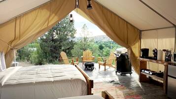
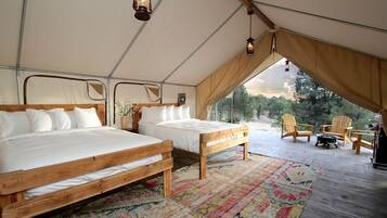
Luxury Camping Rental near Zion Nation Park for Utah Glamping
Luxury Camping Rental near Zion Nation Park for Utah GlampingOrderville
De prijs is € 333
inclusief belastingen en toeslagen
5 jul - 6 jul

Glamping Tent # 8 in East Zion Resort (twee queensize bedden)
Glamping Tent # 8 in East Zion Resort (twee queensize bedden)Orderville
10.0 van 10, Uitzonderlijk, (1 beoordeling)
'Nice stay in a quiet and friendly glamping resort. The pool and hot tub amenities were excellent and we were able to make use of them. However, if you are looking for a place that is totally isolated and free from light pollution this is not the place. The reason I chose this experience was to look at the stars and while some could be seen the proximity to the highway obstructed this . Overall the accommodations were clean and matched exactly to the description. However there was no security at...
Giovanna B.
De prijs is € 307
inclusief belastingen en toeslagen
3 aug - 4 aug


Glamping Tent # 4 in East Zion Resort (twee queensize bedden)
Glamping Tent # 4 in East Zion Resort (twee queensize bedden)Orderville
9.0 van 10, Fantastisch, (4 beoordelingen)
'Wir hatten ein Zelt im East Zion Resort gebucht.
Das Zelt war sauber und super ausgestattet. Auch der Kontakt mit dem Besitzer verlief freundlich und hilfsbereit.
Der obere Pool war super schön. Allerdings ist das Resort öffentlich zugänglich. Das heißt, dass jeder in die Zelte kann, da man diese nicht verschließen kann, weshalb ich mich unsicher gefühlt habe.
Gegen Abend wollten wir noch in den Pool was leider nicht möglich war. Es standen mindestens 6 Autos davor und der Pool war bereits...

Nicole


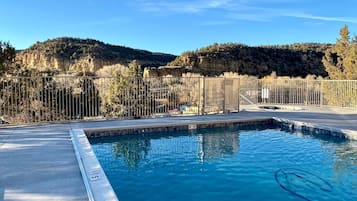
Glamping Tent # 10 in East Zion Resort
Glamping Tent # 10 in East Zion ResortOrderville
10.0 van 10, Uitzonderlijk, (4 beoordelingen)
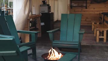
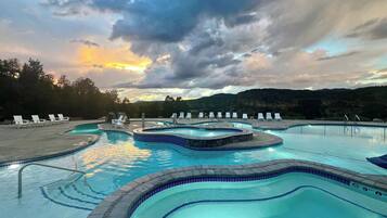
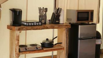
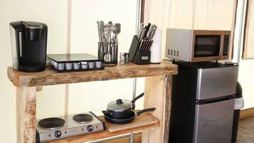
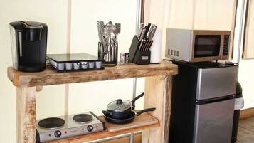
'The hospitality of this resort is outstanding! They thought of EVERY comfort in what was provided in our glamping tent, including heat or air conditioning, as well as stocked supplies, utensils and cookware. The resort is incredibly creative with the variety of lodging choices and two separate pools to enjoy, plus a laundry facility that we were glad to use. Thoughtful touches such as flickering solar lighting all around created a dreamy vibe, along with the gas fire pits and Adirondack chairs...
Bradley C.
De prijs is € 307
inclusief belastingen en toeslagen
31 jul - 1 aug

Glamping Tent # 3 in East Zion Resort (King Suite)
Glamping Tent # 3 in East Zion Resort (King Suite)Orderville
De prijs is € 253
inclusief belastingen en toeslagen
6 jul - 7 jul


Laagste prijs per nacht gevonden in de afgelopen 24 uur op basis van een verblijf van 1 nacht voor 2 volwassenen. Prijzen en beschikbaarheid kunnen wijzigen. Mogelijk gelden er extra voorwaarden.
Vind accommodaties die bij jou passen
Huisjes
Aparthotels

Bespaar gemiddeld 15% op duizenden hotels wanneer je bent aangemeld
De beste hotelbeoordelingen voor Alton

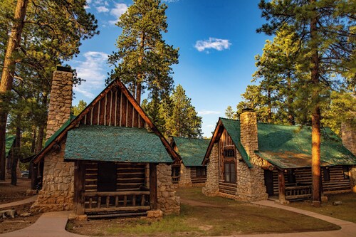
Mountain Ridge Cabins and Lodging
10/10 Voortreffelijk

Ontdek meer over Alton
Informatie over Campings en stacaravans in Alton
Aantal beoordelingen | 32 |
|---|---|
Accommodatie | 726 |
Laagste prijs | € 253 |
Hoogste prijs | € 344 |
Veelgestelde vragen
Ontdek de wereld met Expedia
- Hotels met zwembad in Zuidwest-Utah - Bryce Canyon
- Luxe in Zuidwest-Utah - Bryce Canyon
- Hotels met waterpark in Zuidwest-Utah - Bryce Canyon
- Hotels met gratis ontbijt in Zuidwest-Utah - Bryce Canyon
- Hotels met zwembad in Panguitch
- Romantische in Panguitch
- Spa in Bryce Canyon
- Hotels voor shoppers in Kanab
- Luxe in Orderville
- Motel 6-hotels in Zuidwest-Utah - Bryce Canyon
- Shilo Inn-hotels in Kanab
- Hotels met 5 sterren in Bryce Canyon
- Hotels in Cannonville
- Hotels in de buurt van Little Hollywood Movie Museum
- Hotels in de buurt van Bryce Canyon National Park Visitor Center
- Hotels in de buurt van Alton Amphitheater
- Hotels in Mount Carmel
- Hotels in de buurt van Thor's Hammer
- Hotels in Kanab
- Hotels in de buurt van Peek-A-Boo Gulch
- Hotels in de buurt van Red Canyon
- Hotels in Duck Creek Village
- Hotels in de buurt van Kodachrome Basin State Park
- Hotels in Hatch
- Hotels in Alton
- Hotels in de buurt van Ebenezer's Barn and Grill
- Hotels in de buurt van Mossy Cave Trail
- Hotels in Brian Head
- Hotels in de buurt van Ponderosa Canyon
- Hotels in de buurt van Sunset Point
- Hotels in Bryce Canyon
- Hotels in de buurt van The Narrows
- Hotels in Tropic
- Hotels in de buurt van Dixie National Forest
- Hotels in de buurt van Nationaal park Bryce Canyon
- Hotels in de buurt van Sunrise Point
- Hotels in de buurt van Bryce Point
- Hotels in Long Valley Junction
- Hotels in Panguitch
- Motels in Springdale
- Blokhutten in Springdale
- Particuliere vakantiehuizen in Kanab
- Motels in Kanab
- Cottages in Kanab
- Motels in Bryce Canyon
- B&B in Virgin
- Motels in Hatch
- B&B in Hatch
- Appartementen in Hatch
- Campings en stacaravans in Zuidwest-Utah - Bryce Canyon
- B&B in Parowan
- Motels in Parowan
- Blokhutten in Duck Creek Village
- Blokhutten in Orderville
- Vluchten naar Bryce Canyon
- Vluchten naar Orderville
- Vluchten naar Tropic
- Vluchten van Bryce Canyon
- Vluchten van Brigham City (BMC) naar Bryce Canyon (BCE)
- Vluchten van San Francisco (SFO) naar Bryce Canyon (BCE)
- Vluchten van Salt Lake City (SLC) naar Bryce Canyon (BCE)
- Vluchten van Kayes (KYS) naar Bryce Canyon (BCE)
- Vluchten van Tokio (NRT) naar Bryce Canyon (BCE)
- Vluchten van Los Angeles (LAX) naar Bryce Canyon (BCE)
- Vluchten van Chicago (ORD) naar Bryce Canyon (BCE)
- Bezoek Kanab
- Bezoek Orderville
- Bezoek Mount Carmel
- Bezoek Panguitch
- Bezoek Brian Head
- Bezoek Bryce Canyon
- Bezoek Tropic
- Bezoek Cannonville
- Bezoek Hatch
- Checkerboard Mesa
- Mossy Cave Trail
- Rim Road Scenic Drive
- Old Bryce Town
- Swamp Canyon
- Vakanties in Duck Creek Village
- Vakanties in Tropic
- Dixie National Forest
- Bryce Point
- Vakanties in Bryce Canyon
- Thor's Hammer
- Nationaal park Bryce Canyon
- Rainbow Point
- Vakanties in Brian Head
- Inspiration Point